We use a vast range of cutting edge technology to complete underground surveys such as (GPR) Ground Penetration Radar, Radio-detection, EML (Electromagnetic Location) and many other procedures to ensure we provide you with the most accurate and reliable underground utility information. PinPoint Mapping have adopted PAS:128 specification for underground utility detection, verification and location to all works to provide the client with the most accurate and consistent results. Once all the services are detected, located and sprayed up on the ground, we use our GPS to record all the location of the services where then a set of as built drawings is generated from all the data that was collected. PinPoint Mapping deliver 2D and 3D drawings in the form of AutoCAD and PDF. PAS:128 specification focuses on the levels of accuracy referred to as survey category types ranging from category D to A.

Category D
Obtaining all utility records from all the utility providers(GNI, ESB, Irish Water, Local councils, Eir, Virgin Media and other service providers
Category C
From the records obtained from all the utility providers the surveyor will then head to site and verify/spray services on the ground as per drawing.

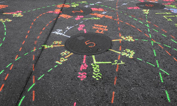
Category B
An on site utility mapping survey using multiple geophysical instruments such as the GPR and EML to identify the exact position of all the services.
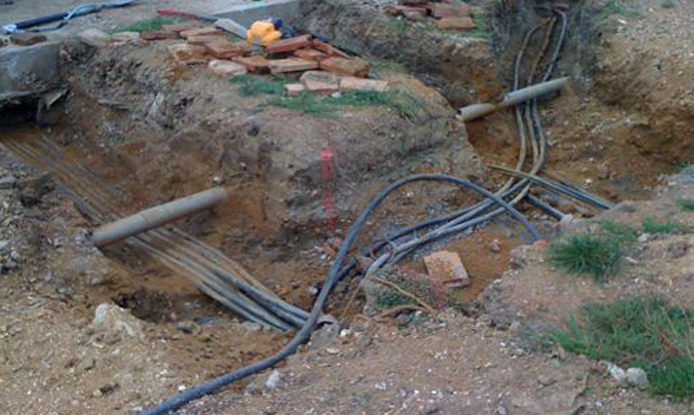
Category A
This involves a visual inspection of all underground services after the area has be excavated by means of a vacuum excavator or hand dug trial holes.
Email: info@pinpointmapping.ie
Tel: 083 379 880 – 083 878 9763