
We obtain all utility records
Obtaining all utility records from all the utility providers(GNI, ESB, Irish Water, Local councils, Eir, Virgin Media and other service providers).

Obtaining all utility records from all the utility providers(GNI, ESB, Irish Water, Local councils, Eir, Virgin Media and other service providers).

An on site utility mapping survey using multiple geophysical instruments such as the GPR and EML to identify the exact position of all the services.
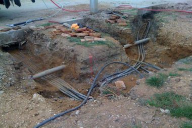
This involves a visual inspection of all underground services after the area has be excavated by means of a vacuum excavator or hand dug trial holes.